-
Mersin Photogrammetry Journal8
-
Türkiye Fotogrametri Dergisi5
-
Anadolu Orman Araştırmaları Dergisi2
-
Applied Geomatics2
-
Erciyes Üniversitesi Fen Bilimleri Enstitüsü Fen Bilimleri Dergisi2
-
OLBA2
-
Photogrammetric Engineering & Remote Sensing2
-
Survey Review2
-
ACM Journal on Computing and Cultural Heritage1
-
Archaeological Prospection1

Kentsel planlama ve çevresel izleme için fotogrametri tabanlı ağaç modelleme
Effects of some varnishes on the thermal conductivity properties of wood based panels
Yiğit, Abdurahman Yasin | Ulvi, Ali
Giriş ve Amaçlar Ağaçların fiziksel özelliklerinin doğru ve detaylı bir şekilde belgelenmesi; karbon emilimi, çevresel analizler ve sürdürülebilir şehir planlaması açısından büyük önem taşımaktadır. Geleneksel ölçüm yöntemlerinin zaman alıcı ve maliyetli olması, mobil cihazlarla gerçekleştirilen dijital tekniklerin alternatif bir çözüm olarak değerlendirilmesine neden olmuştur. Bu çalışmanın amacı, düşük maliyetli fotogrametri teknikleri kullanılarak tek bir ağacın üç boyutlu (3B) modelini üretmek ve bu model üzerinden metrik doğruluk analizleri gerçekleştirmektir. Yöntemler Çalışma, Mersin Üniversitesi kampüsünde konumlanan tek bir ağaç örneği üzerinde yürütülmüştür. Mobil cihaz ile toplam 95 adet fotoğraf çekilmiş; bu görüntüler Agisoft Metashape yazılımı ile Hareketten Yapı (Structure ...
Dijital İkiz Oluşturmada Nokta Bulutlarına Dayalı Analiz
Point Cloud-Based Analysis in Digital Twinning
Yiğit, Abdurahman Yasin
Teknolojinin gelişimi ile gerçek dünyadaki nesneler sanal ortama aktarılmaya başlanarak hedef nesneye ait tüm veri akışları ve süreçleri yönetme ihtiyacı daha kolay sağlanmış olmaktadır. Dijital ikizlerin en önemli özelliği, gerçek dünyayı olabildiğince doğru ve güncel yansıtmasıdır. LiDAR ve fotogrametri yöntemi kullanımı, fiziksel ortamların üç boyutlu nokta bulutlarının oluşturulmasında oldukça popüler hale gelmiştir. Dijital ikizler, gerçek dünyayı detaylı bir şekilde temsil edebilmesinin yanı sıra en faydalı özelliklerinden biri de nokta bulutlarının doğrudan kullanıma uygun olmasıdır. Bu sayede, fazla işlem adımına gerek kalmadan doğrudan bir dijital ikiz için üç boyutlu geometrik model olarak nokta bulutları kullanılabilmektedir. Üç boyutlu geometrik modeli güncellemek için değişen ...
Investigation and Implementation of New Technology Wearable Mobile Laser Scanning (WMLS) in Transition to an Intelligent Geospatial Cadastral Information System
Yiğit, Abdurahman Yasin | Ulvi, Ali | Yakar, Murat
The human population is constantly increasing throughout the world, and accordingly, construction is increasing in the same way. Therefore, there is an emergence of irregular and unplanned urbanization. In order to achieve the goal of preventing irregular and unplanned urbanization, it is necessary to monitor the cadastral borders quickly. In this sense, the concept of a sensitive, up-to-date, object-based, 3D, and 4D (4D, 3D + time) cadastral have to be a priority. Therefore, continuously updating cadastral maps is important in terms of sustainability and intelligent urbanization. In addition, due to the increase in urbanization, it has become necessary to update the cadastral information system and produce 3D cadastral maps. However, since there are big problems in data collection in urb...
Dijital ikizlerin geliştirilmesinde fotogrametrinin kullanımı ve artırılmış gerçeklik ile görselleştirilmesi
Use of photogrammetry in the development of digital twins and visualization with augmented reality
Yiğit, Abdurahman yasin
Dijital ikiz oluşturmada en önemli kavram, objenin gerçekliği ne kadar iyi temsil ettiği ve güncellenebilir olmasıdır. Fotogrametri yöntemi bu noktada fotoğraflardan 3B modeller oluşturma yöntemi olduğu için gerçekliği en iyi temsil eden yöntemlerden biridir. Fotogrametri yöntemiyle bir nesnenin farklı açılardan birden fazla fotoğrafı çekilerek nesnenin 3B modeli oluşturulabilir ve bu modeller daha sonra dijital ikiz oluşturmak için kullanılabilir. Çalışmanın ana odak noktası fotoğraf verilerinden üretilen 3B fotogrametrik verilerin dijital ikiz olarak işlev görmesi için bir temsilin temel gereksinimlerini formüle etmek ve bu temel gereksinimlerin bir prototip dijital ikizde nasıl uygulanabileceğini göstermektir. Bu amaç doğrultusunda farklı boyutlarda ve karmaşık yapıdaki üç adet objenin ...
Discontinuity set extraction from 3D point clouds obtained by UAV Photogrammetry in a rockfall site
Yiğit, Abdurahman Yasin | Ulvi, Ali | Alptekin, Aydın | Yakar, Murat
Rockfall event is common on rocky terrain, and it threatens people. Recent advances in remote sensing technologies allow us to model the terrain with high accuracy and resolution. In this study, we show the application of modeling a rockfall site in three-dimensional (3D) using an unmanned aerial vehicle. The acquisition of information about discontinuities in the rock masses using 3D point clouds is vital to characterize rockfall dynamics. We obtained 3D spatial information and point clouds of a rocky slope from acquired images. We extracted 10 discontinuity sets from the 3D model as they have significant effects on the failure mechanism. Details in mapping discontinuities have improved significantly with the help of point clouds. The results are beneficial for modeling the terrain of ina...
Comparison of the Wearable Mobile Laser Scanner (WMLS) with Other Point Cloud Data Collection Methods in Cultural Heritage: A Case Study of Diokaisareia
Yiğit, Abdurahman Yasin
For the protection of cultural heritage, modern techniques have been used alongside traditional methods in recent years. In addition to two modern measurement techniques (Unmanned aerial vehicle photogrammetry and terrestrial laser scanner) that have been the subject of much research as a three-dimensional (3D) data collection technique for the documentation of cultural heritage, the Wearable Mobile Laser Scanner (WMLS) technique has also recently been included in the research. Especially in cultural heritage documentation, it is essential to obtain accurate and precise data as well as fast and high-quality data. This study includes the visual and statistical comparison of the WMLS measurement method, which enables fast data collection, working with the simultaneous localization and mappin...
Su Altı Yapılarının 3B Modellemesi ve Dokümantasyonunda Kullanılan Video ve Fotoğraf Çekimi Yöntemlerinin Karşılaştırmalı Analizi
Yiğit, Abdurahman Yasin | Ulvi, Ali | Yakar, Murat
Su altındaki bir cismin üç boyutlu olarak belgelenmesi ve dijital platformlara aktarılması son yıllarda önem kazanmıştır. Bu amaçla fotogrametri yöntemi su altında denenmiş ve sualtı fotogrametrisi terimi literatürde kendine yer bulmuştur. Fotogrametri yönteminin tercih edilmesinin en önemli nedeni geleneksel yöntemlere göre daha kısa sürede veri üretimi, zaman ve maliyet açısından olumlu katkı sağlamasıdır. Ancak su altında fotografik veri toplayan dalgıçlar su altında sınırlı bir süre kalabildikleri için fotoğraflama işlemi tekrarlanmakta ve süreç uzamaktadır. Bu olumsuzluğu en aza indirmek için video çekim yöntemiyle veri elde etme çalışmaları denenmeye başlanmıştır. Bu çalışmada, bir havuza test amaçlı obje yerleştirilerek hem fotoğraf çekim hem de video çekim yöntemi ile üç boyutlu mo...
Investigation of The Rainwater Harvesting Potential at the Mersin University, Turkey
Yiğit, Abdurahman Yasin | Ulvi, Ali | Orhan, Osman
The rapid population growth in the world and the adverse effects of climate change, has caused a severe increase in water demand used in sectors such as agriculture, industry, and domestic usage. The fact that the water resources in the world are stable and their availability is limited, the importance of water resources, efficient use of water, and the use of technologies related to alternative water resources have become important. This study aimed to investigate the usage potential of rainwater to be collected from the roofs of the building in irrigation of green areas in Mersin University - Çiftlikköy campus. For this purpose, first, whether the roofs inside the campus can collect rainwater will be revealed with unmanned aerial vehicles. Then, appropriate roof areas where rainwater wil...
Combination of Terrestrial Laser Scanning and Unmanned Aerial Vehicle Photogrammetry for Heritage Building Information Modeling: A Case Study of Tarsus St. Paul Church
Yiğit, Abdurahman Yasin | Ulvi, Ali | Fidan, Şafak
Cultural heritage building information modeling (HBIM) is an emerging process allowing us to reconstruct built heritage virtually. The data of a digitally documented cultural heritage building offers significant advantages as it is accessible and modifiable by all professionals involved in the same or different projects. The most important factor affecting the accuracy and precision of the HBIM model is the ability to collect complete and accurate information about the physical structure. Combining terrestrial laser scanning (TLS) and unmanned aerial vehicle (UAV) photogrammetry point clouds is one of the most efficient ways to capture accurate digital data on the building. This study provides the foundation for creating an HBIM model for cultural heritage the coupling of spatial data with...
Measurement-Based Evaluation of Photogrammetric Accuracy in Small Object Models Using Turntable and Manual Acquisition
Yiğit, Abdurahman Yasin | Ulvi, Ali
Accurate and efficient 3D reconstruction of small-scale objects remains challenging due to intricate geometries, limited imaging volumes, and sensitivity to acquisition conditions. This study presents a quantitative comparison between two close-range photogrammetric acquisition methods: a conventional manual tripod setup and a custom-built, automated turntable platform controlled by an Arduino microcontroller. Four geometrically distinct objects were reconstructed using both approaches and analyzed through a unified Structure-from-Motion (SfM) workflow. Dimensional accuracy was assessed using reference measurements obtained with a digital vernier caliper (±0.01 mm precision), while geometric fidelity was evaluated through Cloud-to-Cloud (C2C) surface deviation analysis. Results consistentl...
Kültürel Mirasın Dijital Ortamda 3 Boyutlu Arşivlenmesi: Maghoki-Attar Camii Sanal Model Örneği
Yiğit, Abdurahman Yasin | Ulvi, Ali
Tüm dünyada kültürel mirasa konu olan eserler sürekli tehdit ve tehlike altında bulunmaktadır. Mimari yapılar ve arkeolojik kazı alanları özellikle; savaşlar, kirlilik (hava kirliliği, asit yağmuru, vb.), bilinçsiz turizmin yanı sıra deprem, sel veya iklim değişiklikleri gibi çevresel felaketler tarafından tehdit edilmektedir. Kültürel mirasın ve arkeolojik alanların korunması ve gelecek nesillere aktarılması amacıyla en hızlı, ayrıntılı ve kolay bir şekilde dijital arşivleme çalışmalarının sürdürülmesi gerekmektedir. Somut kültürel miras eserleri, dijital kameralar yardımıyla fotoğraflanarak 2 boyutlu (2B) olarak arşivlenebilmektedir. Bilgisayar ve bilgi teknolojilerindeki son gelişmelerle birlikte, somut kültürel mirasın 3 boyutlu (3B) modelleri oluşturularak arşivleme çalışmaları hız ka...

Yüksek Çözünürlüklü İnsansız Hava Aracı (İHA) Görüntülerinden Karayolların Tespiti
Yiğit, Abdurahman Yasin
Şehir planlaması, meteoroloji, ormancılık, madencilik, tarımsal jeoloji, peyzaj ve haritacılık gibi birçok alanda yüksek çözünürlüklü görüntülerde bulunan bilgilere çeşitli amaçlar için ihtiyaç duyulmaktadır. Yüksek çözünürlüğe sahip görüntülerde yoğun veriler bulunmaktadır ve bu yoğun verilerden istenen detayların otomatik veya yarı otomatik tespiti yapılacak çalışmaya hız, maliyet ve doğruluk açısından katkı sağlamaktadır. Gelişmiş detay çıkarma yöntemleri sayesinde otomatik detay tespiti daha hızlı ve kolay hale gelmiştir. Bu çalışmada İnsansız Hava Aracı (İHA) ile görünür bölgede (kırmızı-yeşil-mavi bant) elde edilen yüksek çözünürlüklü ham veriler değerlendirilip nesne tabanlı sınıflandırma yaklaşımı ile otomatik karayolu tespiti yapılmıştır. Nesne tabanlı sınıflandırma yöntemiyle; ko...
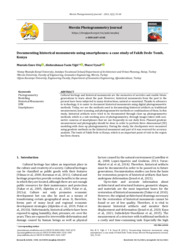
Documenting historical monuments using smartphones: a case study of Fakih Dede Tomb, Konya
Yiğit, Abdurahman Yasin
Cultural heritage and historical monuments are the memories of societies and enable future generations to learn about the past. However, historical monuments from the past to the present have been subjected to many destructions, natural or unnatural. Thanks to advances in technology, it is easier to document historical monuments using digital photogrammetric methods. Today, we see the methods used in documenting historical artifacts as traditional measurement, laser scanning, and photogrammetric methods or combinations of them. In this study, historical artifacts were tried to be documented through close-up photogrammetry methods, which is a sub-working area of photogrammetry, through images taken with non-metric cameras of smartphones that we use frequently in our daily lives. Planned geo...
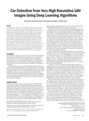
Car Detection from Very High-Resolution UAV Images Using Deep Learning Algorithms
yiğit, abdurahman yasin | yakar, murat
It is important to determine car density in parking lots, especially in hospitals, large enterprises, and residential areas, which are used intensively, in terms of executing existing management systems and making precise plans for the future. In this study, cars in parking lots were detected using high-resolution unmanned aerial vehicle (UAV) images with deep learning methods. We tested the performance of the two approaches by determining the number of cars in a parking lot using the You Only Look Once (YOLOv3) and Mask Region–Based Convolutional Neural Networks (Mask R-CNN) approaches as deep learning methods and the deep learning tool of Esri ArcGIS Pro. High-resolution UAV images were processed by photogrammetry and used as input products for the R-CNN and YOLOv3 algorithm. Recall, F1 ...

Comparative analysis of mobile laser scanning and terrestrial laser scanning for the indoor mapping
Yiğit, Abdurahman Yasin | Ulvi, Ali | Yakar, Murat
Efficient three-dimension exploration of a complex indoor environment remains a difficult duration in mapping accuracy requirements for geometric data. Indoor and outdoor mapping, which has been done with classical measuring devices for a long time, has come a long way with the use of laser scanning technology in this field. Although terrestrial laser scanning (TLS) point cloud recording provides great convenience in indoor and outdoor mapping, it is disadvantageous in terms of time and cost. Therefore, in our study, we propose a new indoor mapping strategy with wearable mobile laser scanning (WMLS) approach, which uses the simultaneous localization and mapping algorithm, which has been tried recently, as an alternative to TLS point cloud. In this strategy, four test areas with different g...
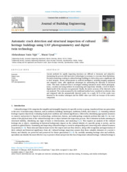
Automatic crack detection and structural inspection of cultural heritage buildings using UAV photogrammetry and digital twin technology
Yiğit, Abdurahman Yasin
Current methods for rapidly inspecting structures are difficult to document and subjective. Automating the process with innovative technologies is necessary to overcome these limitations. Precisely monitoring cracking in cultural heritage buildings is vital as they pose a significant risk to their integrity. Recent advancements in artificial intelligence, including imaging equipment and computer vision, offer significant advantages for automating the detection of structural cracks. This study conducted tests to investigate utilizing unmanned aerial vehicle photogrammetry, a modern surveying method, for monitoring such inspections. Initially, a level of detail 3 digital model of the structure was generated. Finally, the metric accuracy of the detected cracks was analyzed. The cracks measure...